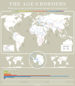
Map created by reddit user PisseGuri82 The map above is a stunning piece of work that shows the when each of the world’s international borders were first defined.
Stunning Map Showing The Age of The World’s Borders
Originally written in English & checked by Managing Editor: Ian WrightLast Updated:
